Land connectivity between India and Sri Lanka has had its pitfalls in the past for reasons including Northern militancy in Sri Lanka, which lasted for nearly three decades.
This militancy disrupted the political environment in the region and made it difficult for both countries to come to an agreement. In addition, the cultural differences between the two countries and the mistrust between them were other factors that hindered the process.
By establishing land connectivity, it will make it much easier to transport goods between the two countries, leading to increased trade that will benefit both countries economically. It will also make it easier for people to travel between the two countries, leading to increased tourism.
However, it has now been identified as a priority and an important decision to establish land connectivity between the two countries for enhanced economic cooperation and growth in other spheres, including technological advancement that would mostly benefit Sri Lanka.
India, as the largest country in the South Asian region, has already established land connectivity with all its neighbours except Sri Lanka.
If Sri Lanka is connected to India through a land bridge, it would be somewhat similar to the Channel Tunnel that connects the United Kingdom with the rest of Europe. The idea of Sri Lanka opening up to the outer world in the late seventies under the stewardship of President J.R. Jayewardene was aimed at achieving economic targets and securing technological know-how. This apparently came through investments from other countries that showed a keen interest in investing in Economic Promotion Zones in the country, probably owing to tax holidays and cheap labour.
The political climate has changed ever since, with India leading from the front as far as South Asian countries are concerned. As India is moving forward at a rapid pace, gathering momentum, and creating an impact the world over as a giant and emerging economy, it is imperative for Sri Lanka to take advantage of the upcoming opportunities and go along with India.
Hence, it is important to establish land connectivity for the economic benefits that Sri Lanka could derive from setting up a bridge connecting India.
Historical records show that there had been land connectivity between India and Sri Lanka, which was later called the Adam’s Bridge. It has been a forgone Islamic belief that Adam’s Peak — where the biblical Adam fell to earth — is located in Sri Lanka and that Adam crossed over to peninsular India via the bridge after his expulsion from the Garden of Eden.
The ancient Sanskrit epic Ramayana, however, says that it was built by the god Rama to secure the release of Seetha from the custody of Ravana, who kidnapped her and concealed her in an unknown place. It has also been mentioned that the bridge across the Indian Ocean was known as Rama Setu and was built by Rama to cross the ocean in search of Seetha.
Subject of discussion
As the idea of a land bridge between the two countries gathered momentum, it became a subject of discussion among policymakers. The High Commissioner for Sri Lanka in New Delhi, Milinda Moragoda, who is also advocating the idea and is a strong supporter of establishing land connectivity between India and Sri Lanka, thought that it was essential for Sri Lanka’s economic revival.
In a recent interview with the Indian media, he said, “Building any causeway or highway across the straits will require environmental impact assessments, and there is a process for that”, Mr. Moragoda told The Hindu in an interview. “If Sri Lanka is looking at this idea of piggybacking on India’s growth story, we have to have land connectivity,” he added.
According to historical evidence, Adam’s Bridge, also known as Rama’s Bridge or Rama Setu, is a chain of natural limestone shoals between Pamban Island, also known as Rameswaram Island, off the south-eastern coast of Tamil Nadu, India, and Mannar Island, off the north-western coast of Sri Lanka.
Geological evidence suggests that this bridge is a former land connection between India and Sri Lanka. A comprehensive study will show some of the regions between the two countries are dry, and the sea in the area rarely exceeds 1 metre (3 ft) in depth, which makes it difficult for a boat with a keel to pass over it. The bridge starts as a chain of shoals at the Dhanushkodi tip of India’s Pamban Island. It ends on Sri Lanka’s Mannar Island.
Pamban Island is accessed from the Indian mainland by the 2-kilometre-long Pamban Bridge. Mannar Island is connected to mainland Sri Lanka by a causeway. During periods of lowered sea levels over the past many years, Adam’s Bridge has provided an intermittent land connection between India and Sri Lanka. According to famous ornithologists Sidney Dillon Ripley and Bruce Beehler, Due to its shallow waters, Adam’s Bridge presents a formidable hindrance to navigation through the Palk Strait.
Though trade across the India-Sri Lanka divide has been active since at least the first millennium BC, it was limited to small boats and dinghies. Large ocean-going vessels from the west have had to navigate around Sri Lanka to reach India’s eastern coast. Eminent British geographer Major James Rennell, who surveyed the region as a young officer in the late 18th century, suggested that a “navigable passage could be maintained by dredging the strait of Ramisseram”.
However, little notice was given to his proposal, perhaps because it came from “so young and unknown an officer”, and the idea was only revived 60 years later. In 1823, Sir Arthur Cotton (then an ensign) was assigned to survey the Pamban channel, which separates the Indian mainland from the island of Rameswaram and forms the first link of Adam’s Bridge.
Geological evidence indicates that a land connection bridged this in the past, and some Ramanathaswamy Temple records suggest that violent storms broke the link in 1480.
Cotton suggested that the channel could be dredged to enable the passage of ships, but nothing was done until 1828. India was, however, interested in dredging the Palk Straits to open up the passage for bigger ships, curtailing their navigation time by at least thirty hours without going around Sri Lanka.
Sethusamudram Canal
The Indian Opposition parties demanded the implementation of the Sethusamudram Canal project using one of the five alternative alignments considered earlier by the government without damaging the structure of Adam’s Bridge. The Government of India constituted nine committees before independence and five committees since then to suggest alignments for a Sethusamudram canal project. Most of them suggested land-based passages across Rameswaram Island, and none recommended alignment across Adam’s Bridge.
The Sethusamudram project committee in 1956 also strongly recommended to the Union government to use land passages instead of cutting Adam’s Bridge because of the several advantages of land passage. In 2005, the Government of India approved a multi-million dollar Sethusamudram Shipping Canal Project. This project was aimed at creating a ship channel across the Palk Strait by dredging the shallow ocean floor near Dhanushkodi. The channel is expected to cut over 400 km (nearly 30 hours of shipping time) off the voyage around the island of Sri Lanka.
This proposed channel’s current alignment requires dredging through Adam’s Bridge. Indian political parties, including the Bharatiya Janata Party (BJP), All India Anna Dravida Munnetra Kazhagam (AIADMK), Rashtriya Janata Dal (RJD), Janata Dal (Secular) (JD(S)), and some Hindu organisations, opposed dredging through the shoal on religious grounds.
Alternative alignment
The contention is that Adam’s Bridge is popularly identified as the causeway described in the Ramayana. The political parties and organisations suggested an alternate alignment for the channel that avoids damage to Adam’s Bridge. The then state and central governments opposed such changes, with Union Shipping Minister T. R. Baalu is a strong supporter of the project, maintaining that the proposal was economically viable and environmentally sustainable and that there were no other alternatives.
Opposition to dredging through this causeway also stems from concerns over its impact on the area’s ecology and marine wealth, the potential loss of Thorium deposits in the area, and the increased risk of damage due to tsunamis. Some organisations oppose this project on economic and environmental grounds and claim that proper scientific studies were not conducted before undertaking it.
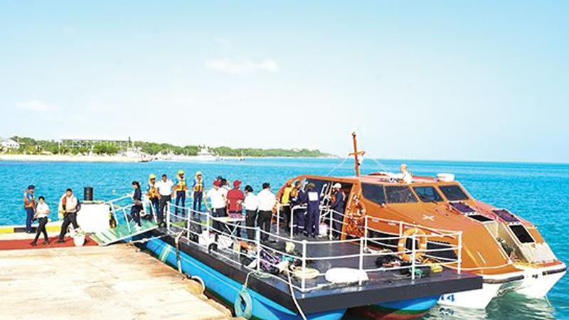
Both countries also released an economic vision document and will engage in talks on a proposed Economic and Technological Cooperation Agreement (ETCA) that is expected to be an upgraded version of an existing free trade pact between the two nations. It was also decided to start passenger ferry services between Nagapattinam in Tamil Nadu and Kankesanthurai in Sri Lanka.
Since relations between the two countries are at their best, a land bridge across the Palk Straits will be a reality soon.