


After visiting Tissamaharama and Kirinda in Ruhuna, on our return journey, we did not miss to visit mighty reservoir of Lunugamvehera. We headed towards the Lunugamvehera reservoir and the beauty was breathtaking. We drove along the dam and soon reached a moment of tranquil peace and dozed off for a moment.
The Lunugamvehera National Park falls within the confines of the Moneragala and Hambantota districts. However, it is a major catchment area for the Lunugamvehera reservoir; and there is a freshness and fertility in the land despite the drought in the area. The area is vital to maintain the water level in five tanks of the Kirindi Oya, which provide water for agriculture and wildlife.
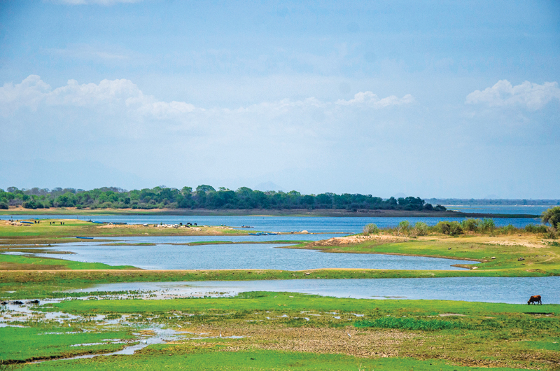
The Lunugamvehera reservoir
during the drought
The three resourceful and principal rivers that flow through the Hambantota and Moneragala districts, are the Kirindi Oya, Menik Ganga and Kumbukkan Oya. When kings ruled over Ruhuna Rata, they not only built Viharas, stupas, dagabas and rock hermitages, but tanks. Their proficiency in diverting rivers such as Menik Ganga, Kirindi Oya and Kumbukkan Oya can be inferred from the relic of the monumental stone anicuts, Bisokotuwas that are seen to this day around Ruhunu Rata.
If one was to scan the topographical sheets of these two districts, Hambantota and Moneragala, one could observe the innumerable tanks dotted in them. Most of these ancient major and minor tanks had been restored to their pristine state during the British times and under the leadership of the late Rt. Hon. D. S. Senanayake, the first Prime Minister of Independent Ceylon. He is fondly called by the people of Sri Lanka, as the Father of the Nation.
Main largest tanks
The old tanks such as Tissa Wewa, Yodakandiya Wewa, Wiravila tank are the main largest tanks in the environs of Tissamaharama. These tanks are filled with the waters of the Menik Ganga which our ancestors had harnessed and were restored during the British times from 1850 to 1925. In modern times in the early 1968, during the post Independent era, steps were taken to tap the waters of the Kirindi Oya, thus creating the Lunugamvehera reservoir which nestles partly in the Hambantota and Moneragala districts bordering the Lunugamvehera National Park.
The Kirindi Oya arising from the Bandarawela hill tops, takes an abrupt descent at Koslanda from where it roars down 570 feet below creating the gushing veil of the picturesque Diyaluma water falls. From these boisterous leaping waters, the lonely Kirindi Oya meanders lazily through the verdant jungle terrain of Wellawaya and empties its waters to the sea at Magama, off Bundala where its estuary lies.
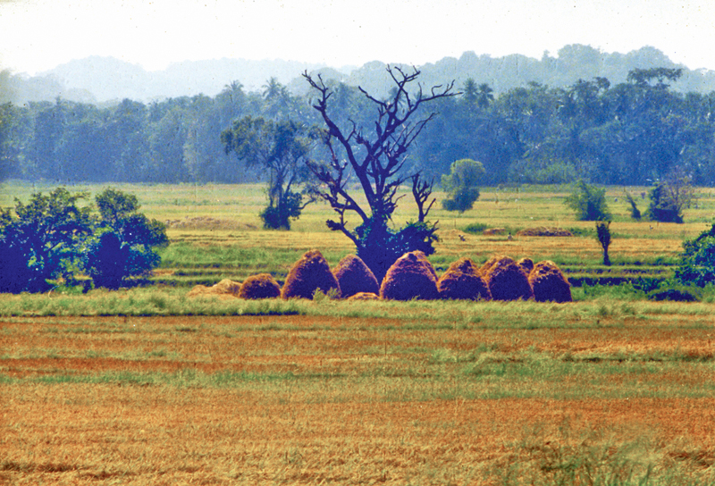
Bountiful harvests of the Lunugamvehera farmers stacked in the paddy fields
This 117 kilometres long Kirindi Oya was tamed for man’s welfare and prosperity in the dim past of over 2000 years ago. In modern times, on the momentous day of June 24, 1968, the foundation stone was laid for the construction of its reservoir, dam and a network of irrigation channels and other infrastructure. Its dam site was at another historic spot close to Lunugamvehera, an ancient site which is reminiscent of Prince Dutugemunu’s epic episodes.
When warrior prince Dutugemunu was preparing his strategies to fight King Elara, Damila king of Anuradhapura, it seems that salt was stored at a certain spot to supply his army. The ancient Dagaba of Lunugamvehera now stands at this spot. Hence the scheme and its reservoir were named as the Lunugamvehera scheme and Lunugamvehera reservoir. Construction work on the head works, the dam and spill way of the Lunugamvehera River Project was executed by the now defunct River Valleys Development Board while construction work on the entire network of irrigation channels was spearheaded by the Department of Irrigation.
Settlement
The Lunugamvehera reservoir and the network of irrigation channels, infrastructure roadways were all completed in 1985. From 1988, the first phase of the settlement of persons commenced, while its final phase of settlement was completed by 1990. Altogether presently about 5,000 families have been resettled. These settlers have been mostly drawn from the Hambantota, Moneragala and Ratnapura districts and among old villagers who had lived in the reservoir-bed area and its environs.
This housing scheme had come into emergence after the 1987 Gam Udawa under the aegis of the National Housing Authority. Three full-fledged townships have sprung up at Lunugamvehera, Weravila and Beralihela on the right and left banks of the Lunugamvehera reservoir.
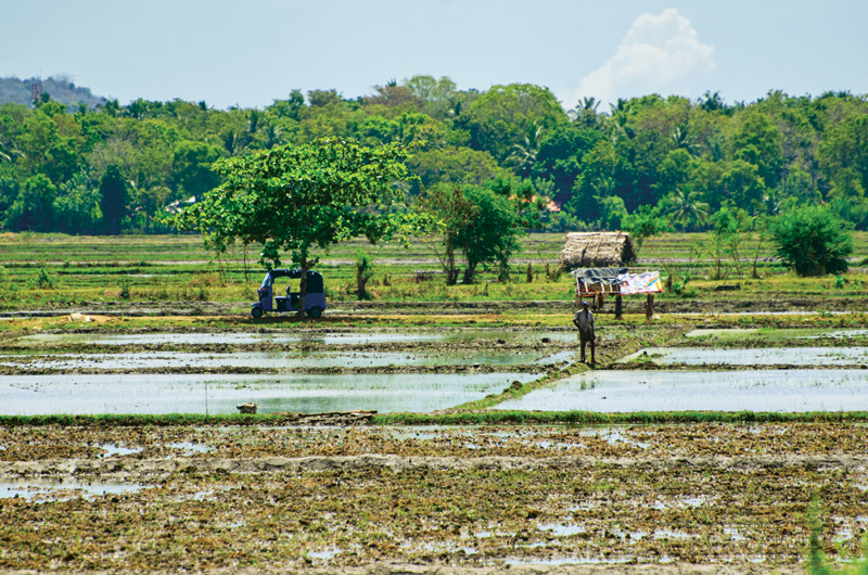
A farmer in a newly tilled paddy field near the Lunugamvehera reservoir
In 1991, a proposal was made to divert the Menik Ganga by the construction of an irrigation channel to replenish the Lunugamvehera reservoir to meet its water deficiency. Then hand in hand with the proposed diversion of Menik Ganga, there was another laudable proposal made to divert the Uma Oya, a tributary of the Mahaweli Ganga by the construction of a tunnel through the Haputale hill range to feed the Lunugamvehera reservoir.
In the 1991/92 period, even the preliminary engineering surveys on the diversion of the Menik Ganga and the construction of a tunnel by the diversion of Uma Oya were carried out.
The Uma Oya Multipurpose Development Project (UOMDP), an irrigation and hydroelectric complex is under construction in Badulla. The complex involves building a dam across the Dalgolla Oya and channeling tunnel to the Mathatilla Oya, both of which are tributaries of the Uma Oya.
At the Mathatilla Oya, another dam is constructed to channel water headrace tunnel to the Uma Oya Power Station, where water discharged to the Alikota Aru via a tailrace tunnel. The Alikota Aru is a tributary of the Kirindi Oya close to the Wellawaya town.
The construction of the complex was inaugurated in April 2008 and the project, under the Ministry of Mahaweli Development, is funded by the Government of Iran. Civil society organisations, community leaders, religious leaders of the Uva province held protest campaigns against the project due to its adverse impact. Local communities say that the underground tunnels had dried up many fresh water springs in the Uva Province.
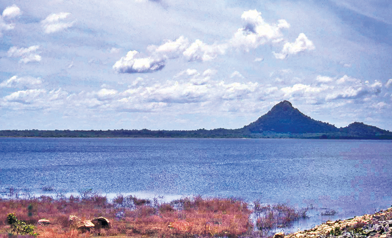
Lunugamvehera reservoir
The Alikota Aru reservoir
in Wellawaya
The Lunugamvehera reservoir has been constructed by damming the Kiridi Oya which flows through Ravan Ella near Wellawaya. The dam of the reservoir is about 6.5 kilometres long and the water is extending in an area of about 7,438 acres and the reservoir has six sluices.
The Lunugamvehera reservoir is set against a scenic and captivating mountain scenery. Overlooking this vast imprisoned waters of the Lunugamvehera reservoir lies its imposing hill, Sittangala rock which reposes itself as a gaunt sentinel. Its other hill ranges are those of Kataragama, Beraliya and Sandagirigala. Most of these mountains had been the seats of an ancient civilisation dating back to the 2nd -3rd century BC.
The Lunugamvehera Project area of today lies within the two ancient provinces, namely the Dolos Daas and Ata Daas Rata. The Ata Daas Rata lies in the region East of the Walawe Ganga, which comes under the Hambantota and Moneragala districts. Thus it would be seen that with the advent of the Lunugamvehera Project heralded another golden era of prosperity and abundance of paddy production bringing back the kingdom of these two ancient provinces to their grandeur.